An online project under the direction of the CAPE ANN MUSEUM
Historic Photographs

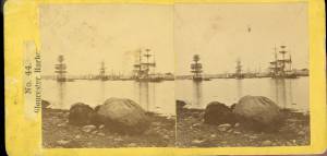
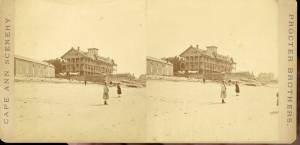
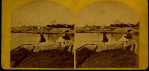
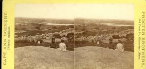
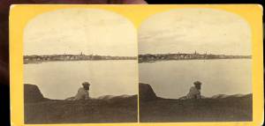
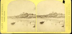
c.1870 Stereograph card Procter Brothers, Publisher Cape Ann Museum Library & Archive
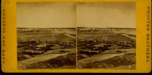
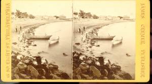
"Gloucester Harbor from Rocky Neck, Looking Southwest. This gives a portion of the Harbor lying between Ten Pound Island and Eastern Point. At the time of taking this picture the wind was from the northeast, and a large fleet of fishing and other vessels were in the harbor. In the range of the picture about one hundred vessels were at anchor. In the small Cove in the foreground quite a number of dories are moored. Eastern Point appears on the left in the background."
Southeast Harbor was known for being a safe harbor.
Also filed under: Gloucester Harbor, Outer » // Rocky Neck » // Schooner (Fishing) » // Small Craft – Wherries, and Dories »
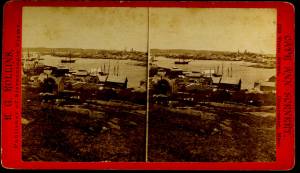
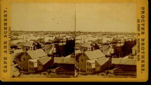
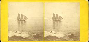
c.1875 Stereograph card Cape Ann Museum Library & Archive
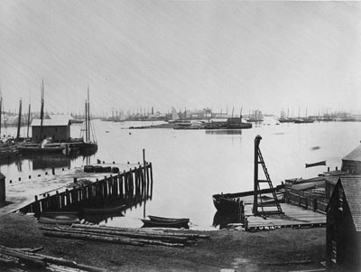
This view of Gloucester's Inner Harbor shows three square-rigged vessels in the salt trade at anchor. The one at left is a (full-rigged) ship; the other two are barks. By the nature of their cargos, they were known as "salt ships" and "salt barks" respectively. Due to their draft (too deep to unload at wharfside) they were partially unloaded at anchor by "lighters" before being brought to the wharves for final unloading.
– Erik Ronnberg
Also filed under: Bark / Barkentine or Demi-Bark » // Salt » // Waterfront, Gloucester »
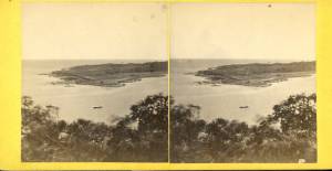
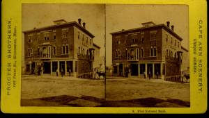
c.1870s Stereograph card Cape Ann Museum Library & Archive
From East Gloucester looking towards Gloucester.
Also filed under: Gloucester Harbor, Inner / Harbor Cove » // Gloucester – City Views »
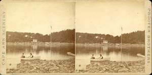
1860s Stereograph card Cape Ann Museum Library & Archive
A view of a Cove on the western side of Gloucester Harbor, with the landing at Brookbank. Houses are seen in the woods back. A boat with two men is in the foreground.
Also filed under: American ensign / flag » // Brookbank » // Fresh Water Cove »
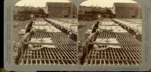
Stereograph card Cape Ann Museum Library & Archive
Also filed under: Cod / Cod Fishing » // Drying Fish » // Flake Yard »
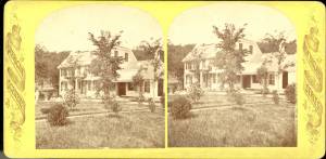
n.d. Stereographic card Cape Ann Museum Library & Archive
Penciled on reverse: "Mansion House, Brook Bank [sic], Sam'l Sawyer now Hammond, Freshwater Cove"
Also filed under: Brookbank » // Sawyer, Samuel »
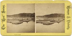
Advertisement for The Bangor News Company, est. January 31, 1881 Castine Historical Society Collections (2008.02)
Also filed under: Lumber Industry »
Stereograph card Cape Ann Museum Library & Archive
Also filed under: Gloucester – City Views »
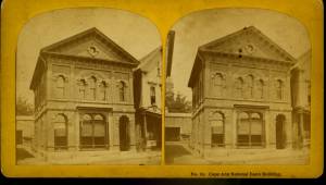
possibly 1884 Stereograph card Cape Ann Museum Library & Archive
Also filed under: Gloucester – City Views » // Sawyer Free Library »
Cape Ann Museum Library & Archive
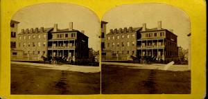
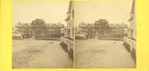
Stereo view
Also filed under: Brick Houses / Gloucester House Hotel »
Stereograph card Cape Ann Museum Library & Archive
Also filed under: Gloucester Harbor, Inner / Harbor Cove » // Gloucester – City Views »
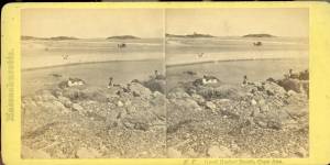
c.1860s Stereograph card Cape Ann Museum Library & Archive
Stereo view
Little Good Harbor Beach looking towards the Farms
Also filed under: Good Harbor Beach / Bass Rocks » // Salt Island »
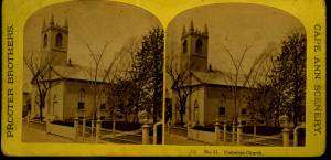
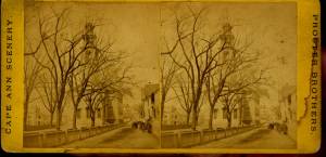
Stereograph card Cape Ann Museum Library & Archive
Also filed under: Procter Brothers » // Unitarian Church / First Parish Church (Middle Street) »
c.1870s Stereograph card Cape Ann Museum Library & Archive
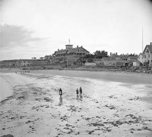
Stereo view of the Pavilion from the southern or sea side.
Also filed under: Pavilion (Publick) Beach » // Pavilion Hotel »
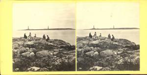
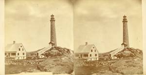
c.1870 Stereograph card Cape Ann Museum Library & Archive
Also filed under: Rockport, Mass. - Thacher Island Twin Lighthouses » // Thacher Island »
Published by Frank Rowell Cape Ann Museum Library & Archive
Stereograph card
Also filed under: Brookbank »
c.1870 Stereograph card Cape Ann Museum Library & Archive
Also filed under: Gloucester – City Views » // Half Moon Beach » // Stage Rocks / Stage Fort / Stage Head » // Steepbank »
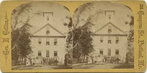
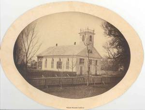
Cape Ann Museum Library & Archive
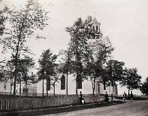
Stereo view of a front and side view of the Church, taken when there was no foliage upon the trees. Church street is also given throughout its length.
Also filed under: Universalist Church (Middle and Church Streets) »
c.1865 Stereograph card Frank Rowell, Publisher stereo image, "x " on card, "x" Cape Ann Museum Library & Archive
View showing a sharpshooter fishing schooner, circa 1850. Note the stern davits for a yawl boat, which is being towed astern in this view.
Also filed under: Schooner (Fishing) »
Stereoview card Cape Ann Museum Library & Archive
Also filed under: White-Ellery House »
c.1870 Stereograph card Cape Ann Museum Library & Archive
Also filed under: Rocky Neck »
Stereograph card Hervey Friend, Gloucester, Mass., Publisher Cape Ann Museum Library & Archive
Stereo view of the Pavilion Hotel from the street side.
Also filed under: Pavilion Hotel »
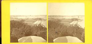
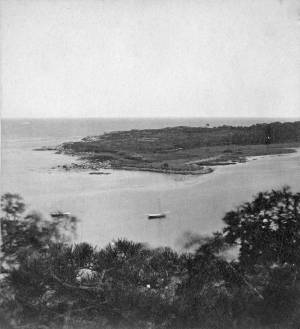
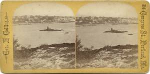
c.1860 Stereograph card Cape Ann Museum Library & Archive
Taken from Steepbank, on the western side of Gloucester Harbor, and showing a small boat at anchor in the cove, then the Neck, and the sea beyond.
Also filed under: Dolliver's Neck » // Fresh Water Cove » // Lone Pine » // Steepbank »
1870s Stereograph card Cape Ann Museum Library & Archive
Also filed under: Annisquam River »
c.1870 Stereograph card Cape Ann Museum Library & Archive
Also filed under: Half Moon Beach » // Stage Rocks / Stage Fort / Stage Head » // Western Shore »
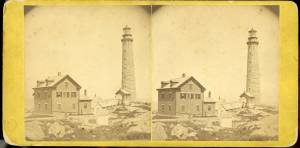
c.1870 Stereograph card Cape Ann Museum Library & Archive
Also filed under: Rockport, Mass. - Thacher Island Twin Lighthouses » // Thacher Island »
c.1870 Stereograph card Cape Ann Museum Library & Archive
Also filed under: Rockport, Mass. - Thacher Island Twin Lighthouses » // Thacher Island »
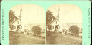
Stereograph card Cape Ann Museum Library & Archive
Stereo view of Brookbank guest house or boathouse.
Also filed under: Brookbank »
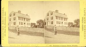
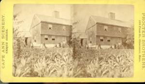
Stereograph card Cape Ann Museum Library & Archive
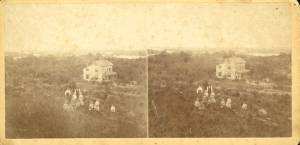
Stereo view of the house owned by Nathaniel Babson (Emma and Maria). The house was sold to Gustavus shortly before Nathaniel's death.
Also filed under: Babson House » // Babson, Nathaniel »
c.1870 Stereograph card Cape Ann Museum Library & Archive
Also filed under: Gloucester – City Views » // Stage Rocks / Stage Fort / Stage Head »
Cape Ann Museum Library & Archive
Stereograph card of Eastern Railroad Depot with 9:30 up train, August 11, 1874.
Also filed under: Eastern Railroad »
Stereograph card Cape Ann Museum Library & Archive
1775–1875 Gloucester's Centennial, August 9th. Stereoscopic views of the celebration.
Also filed under: Gloucester – City Views »
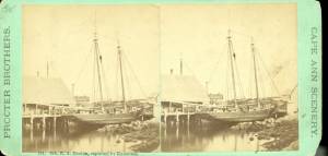
1870s Stereograph card Cape Ann Museum Library & Archive
"Said schooner was captured about the first of September, 1871, by Capt. Torry, of the Dominion Cutter 'Sweepstakes,' for alleged violation of the Fishery Treaty. She was gallantly recaptured from the harbor of Guysboro, N.S., by Capt. Harvey Knowlton., Jr., (one of her owners,) assisted by six brave seamen, on Sunday night, Oct. 8th. The Dominion Government never asked for her return, and the United States Government very readily granted her a new set of papers."
Also filed under: Fishing » // Schooner (Fishing) » // Waterfront, Gloucester »
c.1870 Stereograph card Cape Ann Museum Library & Archive
Also filed under: Half Moon Beach »
c.1890 Stereograph card Cape Ann Museum Library & Archive
"In the foreground is a clear sheet of water which washes upon the beach beyond. The Pavilion is quite prominent, while upon the rising background can be seen the steeples of the several churchs, the tower of the first Town House, and the Collins School House."
Also filed under: Gloucester – City Views » // Pavilion Hotel » // Stage Rocks / Stage Fort / Stage Head »
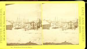
1876 Stereograph card Cape Ann Museum Library & Archive
Stereo view showing Gloucester Harbor after a heavy snowfall
Also filed under: Gloucester Harbor, Inner / Harbor Cove » // Waterfront, Gloucester »
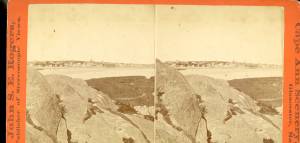
c.1880 Stereograph card Cape Ann Museum Library & Archive
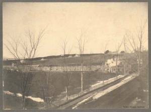
"Bond's Hill is a high eminence on the west side of Gloucester Harbor. The foreground is very rocky and shows a portion of the old road to West Gloucester and Essex, used before the road was built across the marsh, which is to be seen in the center of the picture. Beyond the marsh road is the canal with its dyke. Then the ground rises and dwelling houses appear, till Lookout Hill (or Mount Vernon Street.) can be seen on the left of the background. On the right of the picture is the 'Cut' road, the only carriage entrance into the main part of the town. Beyond it is to be seen 'Crescent Beach,' with the Pavilion and 'old Fort' and a portion of East Gloucester in the background. In the centre of the picture can be seen the unfinished tower of the Town House, and in the distance is the open sea, with Thatcher's Island and its lighthouses just discernible."
Also filed under: Gloucester – City Views » // Pavilion Hotel »
c.1870s Stereograph card Cape Ann Museum Library & Archive
Also filed under: Pavilion (Publick) Beach » // Pavilion Hotel »

c.1870 Stereograph card Procter Brothers, Publisher Cape Ann Museum Library & Archive
View from Civil War fort on Eastern Point.
Also filed under: Eastern Point » // Gloucester Harbor, Outer »
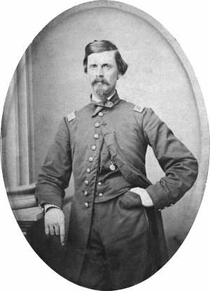
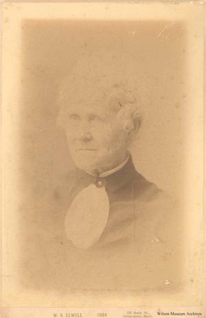
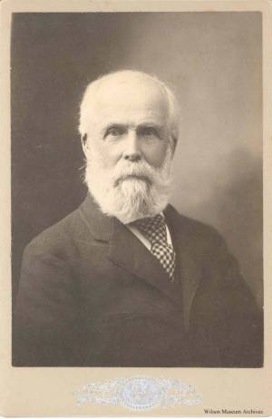
c. 1864 Carte de visite Cape Ann Museum Library & Archive
Also filed under: Center, Addison »
Stereograph card Castine Historical Society Collections (2007.09)
Also filed under: Castine – School »
Stereograph card Castine Historical Society Collections (1996.1)
Also filed under: Castine »
Stereograph card Castine Historical Society Collections (1998.34)
Also filed under: Castine »
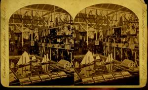
Stereograph card Cape Ann Museum Library & Archive
Diorama of Gloucester fishing boats, which includes several models now in the collection of the Cape Ann Museum
Also filed under: Fishing » // Ship Models »
Stereograph card Castine Historical Society Collections (1996.1)
Also filed under: Castine » // Castine, Maine – Dice (Dyce) Head Lighthouse »
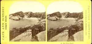
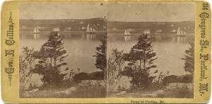
1860s Stereograph card Cape Ann Museum Library & Archive
"Cape Ann Scenery, John S. E. Rogers, Low's Block. #54 Dolliver's Neck. Taken from Steepbank, on the western side of Gloucester Harbor, and showing a small boat at anchor in the cove, then the Neck and the sea beyond."
Also filed under: Dolliver's Neck »
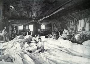
Wilson Museum, Castine (A02428)
On the back of the photo, written:"Business was run by John Dresser – but the sacred process of curing the lines was devised by an employee – and Italian– but called "Surry." "The Castine Lines" were well known in fishing interests from Boston to the Provinces.
After the long lease was out of this land, Mr. E. H. Carpenter built a new factory on rhe north end. The new factory was struck by big storm."
Also filed under: Castine – Dresser's Ropewalk »
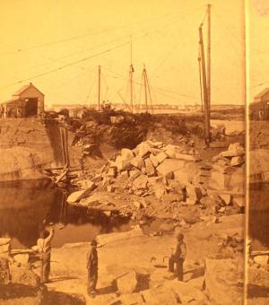
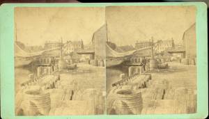
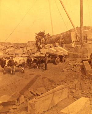
c.1880 Stereograph card Cape Ann Museum Library & Archive
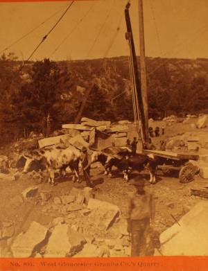
This view shows a wood derrick for hoisting granite blocks.
Also filed under: Eastern Point » // Granite Quarrying / Shipping »
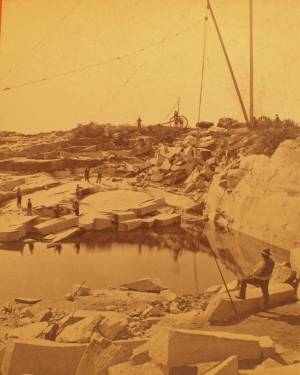
c.1880 Stereograph card Cape Ann Museum Library & Archive
This view shows a wood derrick for hoisting granite blocks.
Also filed under: Eastern Point » // Granite Quarrying / Shipping »
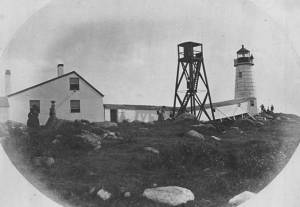
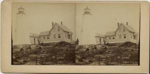
Photograph U.S. Coastguard
For over 100 years the fishermen of Gloucester have been guided back to their home port by a lighthouse on Eastern Point. The present brick tower, painted a gleaming white, and standing on the long rocky point forming the eastern side of the harbor, was built in 1890, replacing on the same foundation the original tower built in 1832. Before 1832 a still older lighthouse, on Ten-Pound Island well inside of the harbor, had served as an entrance light, but this light was never visible until ships had actually found the entrance, hence the building of a lighthouse on the Eastern Point where it could be seen from far offshore.
Courtesy United States Coast Guard.
Also filed under: Gloucester, Mass. – Eastern Point Light »

c.1870 Stereograph card Procter Brothers, Publisher Cape Ann Museum Library & Archive
Also filed under: Gloucester Harbor, Outer » // Stage Rocks / Stage Fort / Stage Head »
Stereograph card Cape Ann Museum Library & Archive
Also filed under: Fishing » // Waterfront, Gloucester »
1876 Photograph Cape Ann Museum Library & Archive
Also filed under: Gloucester Harbor, Inner / Harbor Cove » // Schooner (Fishing) » // Waterfront, Gloucester »
Stereograph card Castine Historical Society Collections (1996.1)
View related catalogue entries (2) »
Also filed under: Beacons / Monuments / Spindles » // Castine »

c.1870 Cape Ann Museum Library & Archive (2013.068)
Schooner fleet anchored in the inner harbor. Looking east from Rocky Neck, Duncan's Point wharves and Lane house (at far left), Sawyer School cupola on Friend Street.
Also filed under: Duncan's Point » // Gloucester Harbor, Inner / Harbor Cove » // Schooner (Fishing) » // Waterfront, Gloucester »
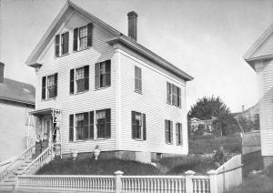
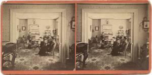
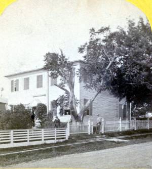
1882 3 x 5 in. cabinet card Collection of the Cape Ann Museum Library & Archives (#20088)
Home of John Trask at 19 Liberty Street, Gloucester. Two women on the stairs are wife and daughter or daughter and housekeeper?
Also filed under: Trask, John »
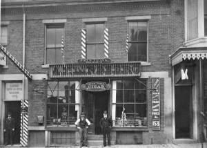
1882 Cabinet card photograph 3 x 5 in. Collection of the Cape Ann Museum Library & Archives (#20133)
Photo of the business of John Trask, tobacconist and cigar maker, at 146 Main Street, Gloucester. Trask is on the left and the older man is not identified.
Also filed under: Trask, John »
1871 Photograph Maine Historic Preservation Commission (2000.24)
Also filed under: Castine – Stevens Home » // Stevens, Joseph, Jr. » // Stevens, Joseph, Sr. and Dorothy Little »
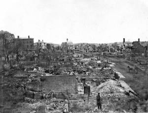
Original print not available; image from copy negative in collection of the Cape Ann Museum.
Also filed under: Gloucester – City Views »
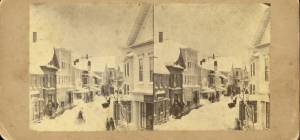
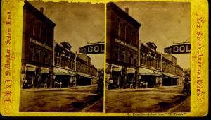
Stereograph card Cape Ann Museum Library & Archive
Looking east down Main Street after storm of April 5, 1861; Centre Street enters from the left at "Job Printing" and John C. Calef, dry goods shop is on the right. (Buck and Dunlap, p. 97).
Also filed under: Gloucester – City Views » // J. C. Calef Dry Goods »
Castine Historical Society Collections (1998.43)
Also filed under: Castine – Millard Dennett's Sail Loft » // Vessel details: Rigging and Sails »
1865 Stereograph card Cape Ann Museum Library & Archive
Also filed under: Universalist Church (Middle and Church Streets) »
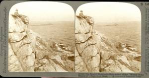
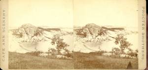
c.1860 Stereograph card Cape Ann Museum Library & Archive
Stereo View: "Geography – Norman's Woe is a headland on the mainland of Massachusetts just south of Gloucester Harbor, which is directly before us here. That very small island, to the left of the cliff, is called Norman's Woe Rock. Both places are so named because of the shipwreck of some member of the Norman family,who were among the early settlers in this locality.
Geology – The irregular jointing shows very clearly along the face of this cliff, where the action of the wind and weathering have cleared away the loose particles between the joints. The reason these rocks have withstood the destructive action of the erosion and weathering is because they are formed cheifly of felspar; in fact, this is a dike of that material.
Literature - Longfellow's poem, "The Wreck of the Hesperus," has immortalized the traditions that centre about these shores. The pounding of the waves uon this rock-bound promontory, and the dismal howling of the wind at this point, furnished him with the inspiration needed for his most favored masterpiece.
People and Homes - Seated upon our left is a very typical New England gentlemen, a real "down east Yankee." He exhibits all the qualities that made his ancestors so staunch in their determination to defend their adopted land."
Also filed under: Norman's Woe »
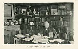
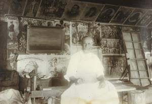
Wilson Museum, Castine, Maine
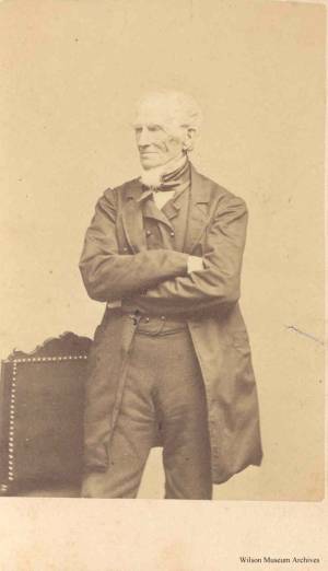
View related catalogue entries (1) »
Also filed under: Brooks, Noah »
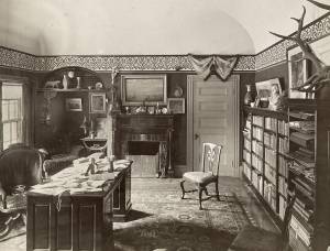
Wilson Museum, Castine, Maine
This photo shows Lane's painting Castine Harbor and Town hanging on the wall of Brooks's library in his home in Castine.
View related catalogue entries (1) »
Also filed under: Brooks, Noah »
c.1870s Stereograph card Cape Ann Museum Library & Archive
Also filed under: Pavilion (Publick) Beach » // Pavilion Hotel »
c.1870 Cape Ann Museum Library & Archive
Taken from Fort Point looking west. Ropewalk just to west of hotel.
Also filed under: Pavilion (Publick) Beach » // Pavilion Hotel » // Ropewalk »
n.d. Photograph Wilson Museum, Castine, Maine (a02153)
Also filed under: Stevens, Joseph, Sr. and Dorothy Little »
n.d. Photograph Wilson Museum, Castine, Maine (a02156)
Also filed under: Stevens, Joseph, Jr. »
n.d. Photograph Wilson Museum, Castine, Maine (a02152)
Also filed under: Stevens, Joseph, Sr. and Dorothy Little »
after 1850 Wilson Museum, Castine, Maine (a2045-1)
Also filed under: Castine – Trinitarian Congregational (Second) Parish (1829) »
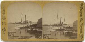
Stereograph card Castine Historical Society Collections (2015.03)
Also filed under: Steamers » // Steamship / Engine-Powered Vessel / Coastal Steamer »
Photograph Castine Historical Society Collections
Also filed under: Castine – First Parish Church (1790) / Unitarian Universalist Church »

1876 Photograph Cape Ann Museum Library & Archive
Ignatius Weber's windmill (now defunct) is shown.
Also filed under: Flake Yard » // Fort (The) and Fort Point » // Gloucester Harbor, Inner / Harbor Cove » // Rogers's (George H.) wharves » // Schooner (Fishing) » // Waterfront, Gloucester » // Windmill »
Stereograph card
Cape Ann Museum Library & Archive
Stereo View
Also filed under: Low, Colonel David » // West Gloucester – Little River »
Print from bound volume of Gloucester scenes sent to the Philadelphia Centennial Exhibition.
11 x 14 in.
Cape Ann Museum Library & Archives
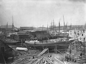
Schooner "Grace L. Fears" at David A. Story Yard in Vincent's Cove.
Also filed under: Schooner (Fishing) » // Shipbuilding / Repair » // Vincent's Cove »
Stereograph
Cape Ann Museum Library & Archive
Also filed under: Granite Quarrying / Shipping »
Stereograph
Cape Ann Museum Library & Archive
Also filed under: Granite Quarrying / Shipping »
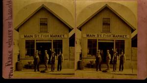
Cape Ann Museum Library & Archive
View shows Main Street Fish Market, Gloucester, Mass.
Also filed under: Fishing » // Gloucester – City Views »